
Introduction
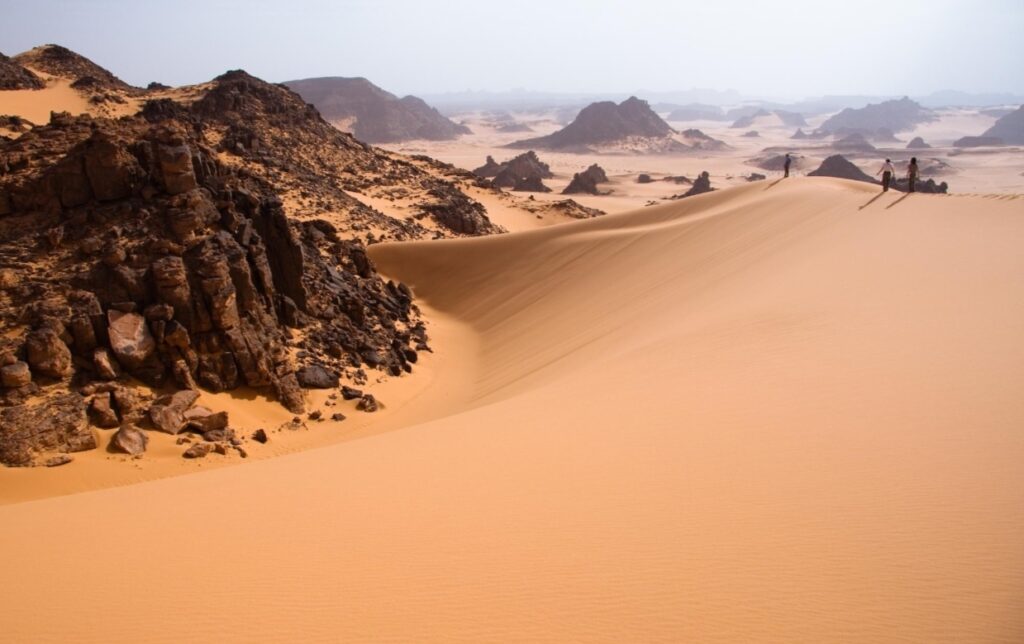
Libya is often associated with the Sahara Desert, but its landscapes are far more diverse. From the forested slopes of Jebel Akhdar and the valleys of eastern Libya to desert lakes, volcanic formations and ancient rock-art landscapes in the south, the country has a remarkable variety of natural scenery. This guide explores 10 of Libya’s most notable natural landscapes and explains what makes each one distinctive.
1. Jebel Akhdar: Libya’s Green Mountain Region
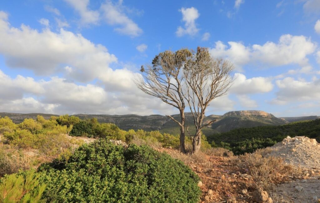
Jebel Akhdar, or the Green Mountain, is one of Libya’s most distinctive natural regions. Located in northeastern Libya, the mountain plateau is greener than much of the surrounding country and contains wooded areas, valleys, limestone landscapes and agricultural land. Its northern slopes receive more rainfall than most parts of Libya, supporting vegetation such as juniper, wild olive and other Mediterranean plants. The landscape also changes noticeably between the higher plateau, valleys and coastal areas, making Jebel Akhdar an important example of Libya’s geographic diversity.
Jebel Akhdar’s vegetation and geography are documented by USGS and scientific sources; current UK travel advice also specifically includes the Jebel Akhdar area in its regional travel warnings.
2. Wadi Al-Kuf: Valleys and Limestone Landscapes
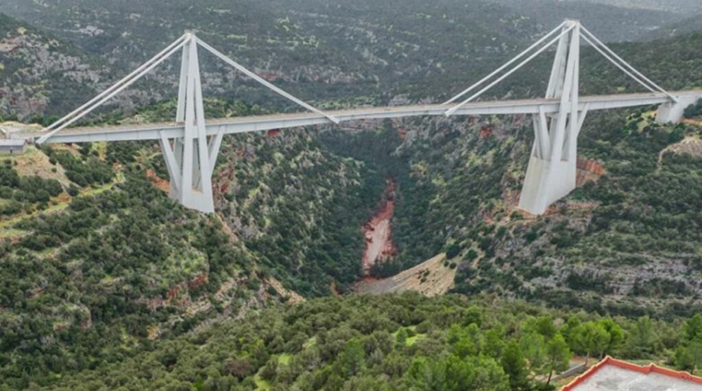
Wadi Al-Kuf is one of the notable valleys of the Jebel Akhdar region. The valley cuts through the limestone landscape of northeastern Libya and forms part of the dramatic scenery around the Green Mountain. The area is also known for the Wadi Al-Kuf Bridge, a large cable-stayed bridge crossing the valley. Beyond the bridge itself, the surrounding cliffs, slopes and vegetation show how different eastern Libya can look from the open desert landscapes farther south.
The Wadi Al-Kuf landscape and bridge are documented in sources covering the Jebel Akhdar region.
3. Ras Al-Hilal and Al-Athrun: Where Mountains Meet the Mediterranean
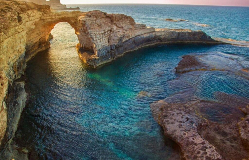
Ras Al-Hilal and Al-Athrun combine Mediterranean coastline with the northern slopes of Jebel Akhdar. The area includes rocky shores, small bays, caves, valleys and green vegetation. The Libyan Ministry of Tourism also highlights natural features around Ras Al-Hilal, including Balfo Waterfall and nearby valleys. The contrast between the sea, limestone cliffs and vegetation makes this part of eastern Libya one of the country’s most varied coastal landscapes.
These features are described directly by Libya’s Ministry of Tourism.
4. Al-Bardiy: Rocky Coast and Quiet Mediterranean Bays
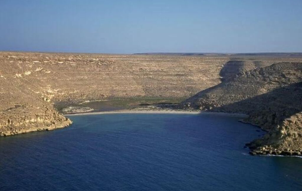
Al-Bardiy is a coastal settlement in eastern Libya known for its bays, rocky shoreline, clear Mediterranean waters and surrounding valleys. The landscape is different from the long sandy beaches commonly associated with North Africa, with small coves, rocky areas and hills creating a more enclosed coastal setting. The surrounding valleys also add another layer to the scenery, making Al-Bardiy an example of the variety found along Libya’s Mediterranean coast.
The Libyan Ministry of Tourism describes Al-Bardiy as a coastal area with bays, beaches, valleys and surrounding natural scenery.
5. Wadi Al-Hayat and the Ubari Desert Lakes
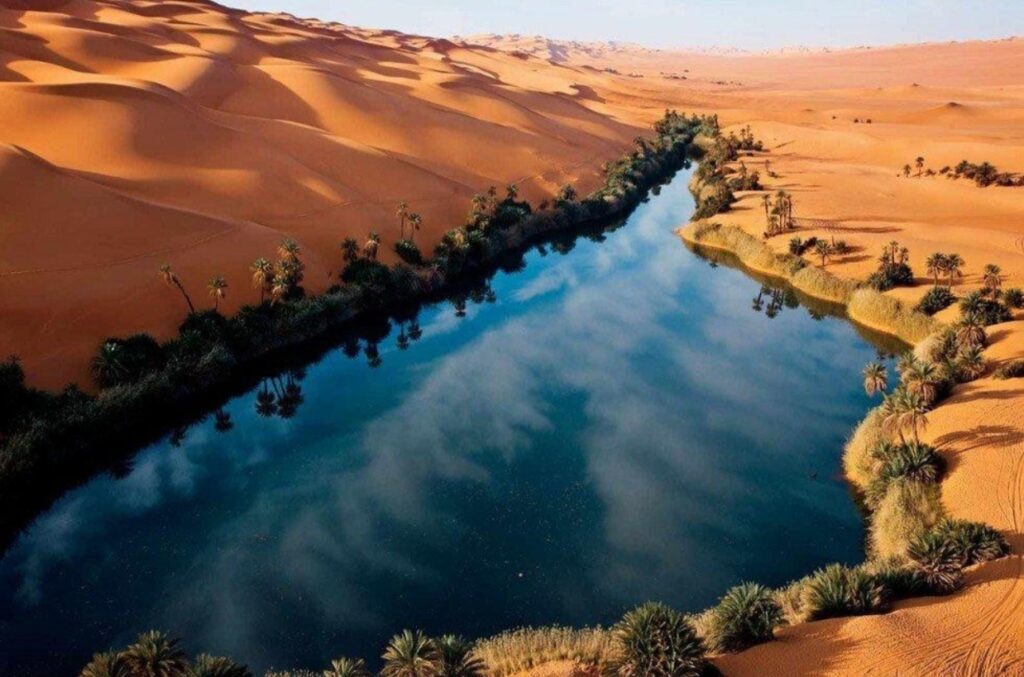
Wadi Al-Hayat stretches across the Fezzan region and combines rocky highlands, desert plains and sand dunes. One of its most remarkable natural features is the group of desert lakes around the Ubari sand dunes, including Gaberoun and Umm Al-Maa. These lakes are surrounded by golden desert landscapes and vegetation, creating a striking contrast between water and sand. The region also contains archaeological and cultural remains connected with the ancient Garamantian civilization, giving the landscape both natural and historical importance.
The Libyan Ministry of Tourism describes Wadi Al-Hayat as a diverse landscape extending for roughly 200 kilometers and identifies several desert lakes in the Ubari area.
6. Tadrart Acacus: Mountains, Canyons and Ancient Rock Art
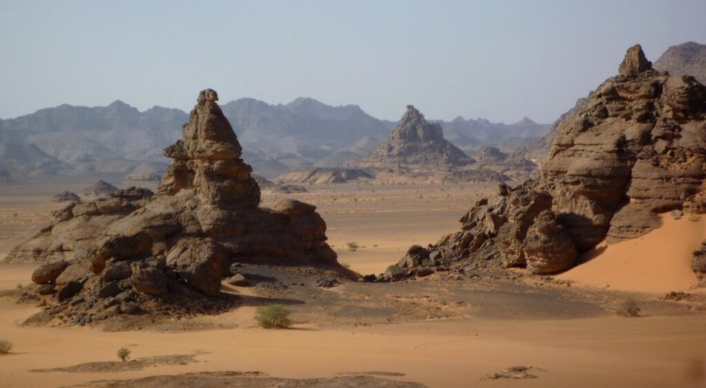
Tadrart Acacus is one of the most remarkable landscapes in the Libyan Sahara. Located near Ghat in southwestern Libya, the mountainous region contains dramatic rock formations, valleys, caves and thousands of prehistoric paintings and engravings. UNESCO recognizes the Rock-Art Sites of Tadrart Acacus as a World Heritage property, with rock art dating from around 12,000 BC to the first century AD. The artwork records major changes in the region’s environment, animals and human societies over thousands of years.
UNESCO confirms the age and importance of the rock art and lists Tadrart Acacus as a World Heritage site in danger.
7. Messak Settafet: A Vast Rocky Desert Landscape
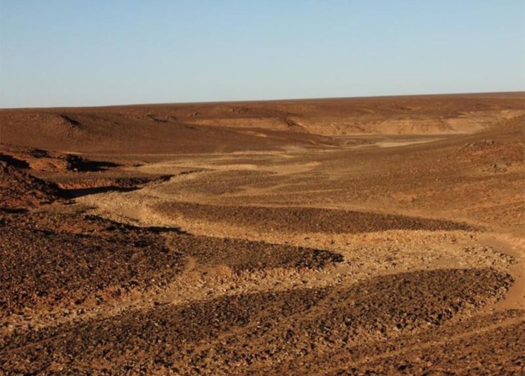
Messak Settafet is a large rocky region in southwestern Libya, characterized by dark desert rock, plateaus, valleys and prehistoric rock-art sites. The Libyan Ministry of Tourism describes the wider Messak area as an important landscape for studying prehistoric art and ancient human activity. Its combination of dark rock surfaces, dry valleys and archaeological evidence makes it very different from the classic image of a Sahara made only of sand dunes.
The Libyan Ministry of Tourism identifies Messak Settafet as a major geological and cultural landscape containing numerous valleys and rock-art sites.
8. Waw an-Namus: A Volcano Surrounded by Desert Lakes
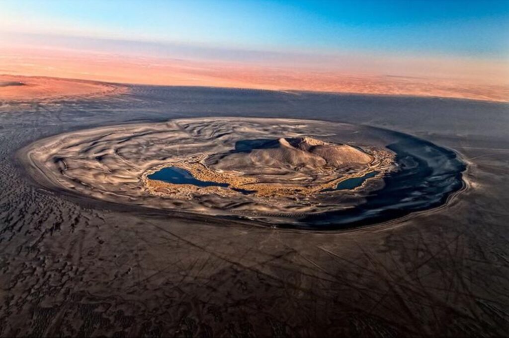
Waw an-Namus is one of Libya’s most unusual geological formations. It lies deep in the Sahara of south-central Libya and consists of a volcanic caldera surrounded by dark basaltic material. Inside the approximately four-kilometer-wide caldera is a volcanic cone and several small salt lakes. The dark volcanic landscape contrasts strongly with the lighter desert around it, creating a distinctive geological scene that has also been documented through satellite imagery.
The Smithsonian Global Volcanism Program records Waw an-Namus as a caldera with a roughly four-kilometer-wide depression and three small salt lakes, while NASA has documented its striking appearance from space.
9. The Haruj Volcanic Field: Libya’s Black Desert
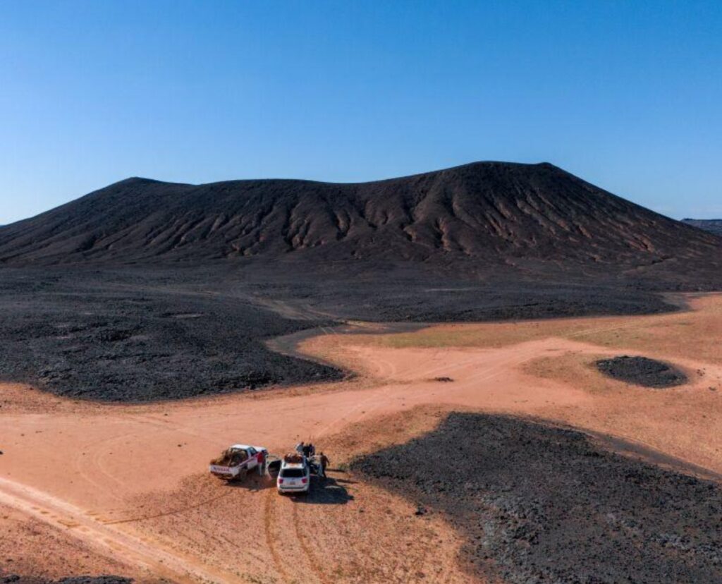
The Haruj volcanic field covers a huge area of central Libya and contains basaltic lava flows, volcanic cones and explosion craters. Unlike the golden sand dunes usually associated with the Sahara, Haruj contains extensive dark volcanic rocks and lava landscapes. Scientific records describe the field as a major volcanic province with many well-preserved volcanic features, making it an important part of Libya’s geological diversity.
10. Jebel Nafusa: The Western Mountain Escarpment
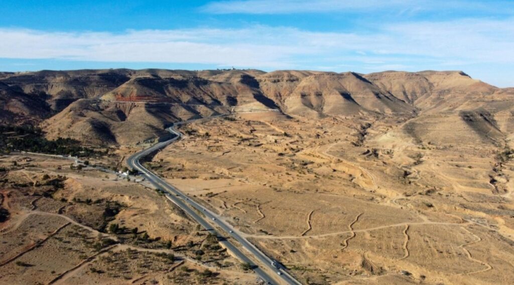
Jebel Nafusa is a mountain range in northwestern Libya that forms a prominent escarpment between the coastal Jifarah Plain and the higher interior plateau. Its limestone formations, valleys and elevated landscapes create a strong contrast with the flat coastal plain. The range extends across a large part of western Libya and forms an important geographic feature of the country’s Tripolitanian region.
USGS geological work describes the Jabal escarpment and identifies its western section from Nalut toward Yafran as Jabal Nefusa.
Important Safety Note for Travelers
Libya’s natural landscapes are geographically fascinating, but current travel conditions must be considered separately from the attractions themselves. As of September 2026, the U.S. Department of State advises against travel to Libya for any reason, citing risks including armed conflict, terrorism, kidnapping, crime, unrest and landmines. The UK Foreign, Commonwealth & Development Office also advises against travel to large parts of Libya. Travel advice can change, so readers should check the latest official government guidance and insurance conditions before making any travel plans.
Current official advisories support this wording. The U.S. advisory is Level 4 “Do not travel,” dated August 31, 2026; the UK advice was updated in July 2026 and remains current.
Why Libya’s Natural Landscapes Are So Diverse
Libya’s natural diversity comes from the meeting of several very different geographic environments. The Mediterranean coast provides rocky shores and coastal valleys, the northeast contains the greener mountains of Jebel Akhdar, while the southwest and central regions contain vast desert plains, sand seas, rocky plateaus and volcanic formations. This variety means that Libya’s landscapes extend far beyond the traditional image of an endless Sahara.
Conclusion
From the green mountains of Jebel Akhdar to the desert lakes of Wadi Al-Hayat, the ancient rock art of Tadrart Acacus and the volcanic landscape of Waw an-Namus, Libya contains a remarkable range of natural environments. These places also show how geography, geology and human history are closely connected across the country. For anyone researching Libya’s landscapes, these 10 locations provide a useful overview of the country’s mountains, valleys, coastlines, oases and desert formations.
Related Travel Guides
• UNESCO World Heritage Sites in Libya: Complete Travel Guide
• Best Beaches in Libya: Top Coastal Destinations